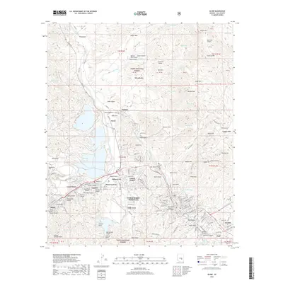
2018 Map of Globe
USGS Topo · Published 2018About this map
The copper-mining district of Gila County comes into focus through this survey of the interconnected communities surrounding Globe and Miami. This area exhibits a complex pattern of industrial and residential growth, where settlements like Claypool, Midland City, and Central Heights form a nearly continuous corridor along the drainage of Bloody Tanks Wash. The topography is defined by the steep rises of Bull Hill, Buffalo Hill, and the Globe Hills, which hem in the urbanized valleys. To the north, the landscape transitions into the protected lands of the Tonto National Forest, where features such as Nugget Mesa and Quartzite Canyon dominate the terrain. Traces of the region's transport and water history are evident in the winding path of the Apache Trl and the numerous springs, including Jasper Spring and Henrietta Spring, that dot the arid canyons.
Find a feature on this map
164 named features on this map. Tap any name to fly to it.
Don’t see what you’re looking for? This feature index may not catch every label — zoom into the map to look around manually.
Map Details
Editions of this 2018 Globe Map
This is the sole edition of this map. No revisions or reprints were ever made.
Other maps of this area

1901 · Globe
USGS Topo · 1:62,500

1902 · Globe
USGS Topo · 1:62,500

1922 · Chrysotile
USGS Topo · 1:125,000

1945 · Globe
USGS Topo · 1:24,000

1945 · Inspiration
USGS Topo · 1:24,000

1947 · Inspiration
USGS Topo · 1:24,000

1948 · Pinal Ranch
USGS Topo · 1:24,000

1949 · Pinal Ranch
USGS Topo · 1:24,000

1949 · Rockinstraw Mtn
USGS Topo · 1:62,500

1950 · Rockinstraw Mtn
USGS Topo · 1:62,500