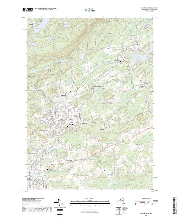
2023 Map of Gloversville
USGS Topo · Published 2023About this map
Gloversville and Johnstown anchor this Fulton County landscape, where the urban grid of the glove-making industrial centers transitions into the foothills of the Adirondacks. Historically significant sites such as Kingsboro and Berkshire are shown alongside numerous local burial grounds including Prospect Hill Cem and the Colonial Cem. The geography is defined by the flow of Cayadutta Creek toward the south and the presence of substantial water bodies like Rice Reservoir and Mountain Lake to the north.
Find a feature on this map
179 named features on this map. Tap any name to fly to it.
Don’t see what you’re looking for? This feature index may not catch every label — zoom into the map to look around manually.
Map Details
Editions of this 2023 Gloversville Map
This is the sole edition of this map. No revisions or reprints were ever made.
Other maps of this area

1895 · Amsterdam
USGS Topo · 1:62,500

1896 · Fonda
USGS Topo · 1:62,500

1898 · Fonda
USGS Topo · 1:62,500

1899 · Broadalbin
USGS Topo · 1:62,500

1902 · Broadalbin
USGS Topo · 1:62,500

1902 · Fonda
USGS Topo · 1:62,500

1903 · Gloversville
USGS Topo · 1:62,500

1931 · Amsterdam
USGS Topo · 1:62,500

1943 · Gloversville
USGS Topo · 1:62,500
1944 · Tribes Hill
USGS Topo · 1:24,000