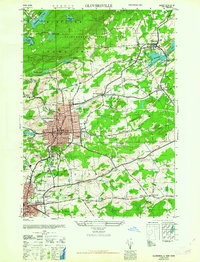
1963 Map of Gloversville
USGS Topo · Published 1963About this map
The industrial centers of Gloversville and Johnstown anchor this mid-century landscape, connected by the vital Fonda Johnstown and Gloversville RR. This map captures the region at a peak of municipal development, showing dense street grids that give way to the rugged southern fringes of Adirondack State Park. Civic life is deeply documented through landmarks like the Littauer Hospital, City Hall, and the Armory, while the surrounding countryside is dotted with historic rural institutions such as Bemis Sch and Frank Sch.
Find a feature on this map
66 named features on this map. Tap any name to fly to it.
Don’t see what you’re looking for? This feature index may not catch every label — zoom into the map to look around manually.
Map Details
Editions of this 1963 Gloversville Map
This is the sole edition of this map. No revisions or reprints were ever made.
Other maps of this area

1895 · Amsterdam
USGS Topo · 1:62,500

1896 · Fonda
USGS Topo · 1:62,500

1898 · Fonda
USGS Topo · 1:62,500

1899 · Broadalbin
USGS Topo · 1:62,500

1902 · Broadalbin
USGS Topo · 1:62,500

1902 · Fonda
USGS Topo · 1:62,500

1903 · Gloversville
USGS Topo · 1:62,500

1931 · Amsterdam
USGS Topo · 1:62,500

1943 · Gloversville
USGS Topo · 1:62,500
1944 · Tribes Hill
USGS Topo · 1:24,000