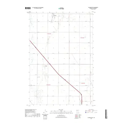
2019 Map of Glyndon South
USGS Topo · Published 2019About this map
Glyndon anchors the northern edge of this agricultural landscape in Clay County, where the plains are defined by a rigid grid of section lines and gravel roads. The southern reaches of the township are drained by the South Branch Buffalo River, also labeled in sections as the S Br Buffalo River, and its small tributary, Stony Cr. This 2019 survey documents the enduring rural infrastructure of the Red River Valley, including significant local landmarks such as the Blue Sky Airport and two historic burial grounds, Elmwood Cem and Sabin Trinity Cem. The map provides a precise look at the township's organization, showing the intersection of local routes like Co Hwy 12 and Co Rd 67 amidst the surrounding farmland.
Find a feature on this map
45 named features on this map. Tap any name to fly to it.
Don’t see what you’re looking for? This feature index may not catch every label — zoom into the map to look around manually.
Map Details
Editions of this 2019 Glyndon South Map
This is the sole edition of this map. No revisions or reprints were ever made.
Other maps of this area

1895 · Fargo
USGS Topo · 1:125,000

1897 · Fargo
USGS Topo · 1:125,000

1919 · Barnesville
USGS Topo · 1:62,500

1919 · Hawley
USGS Topo · 1:62,500

1952 · Barnesville
USGS Topo · 1:62,500

1953 · Fargo
USGS Topo · 1:250,000

1956 · Fargo
USGS Topo · 1:250,000

1964 · Sabin
USGS Topo · 1:24,000

1964 · Baker
USGS Topo · 1:24,000

1964 · Dilworth
USGS Topo · 1:24,000