
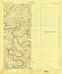
1928 Map of Godley
USGS Topo · Published 1928About this map
The Brazos River creates a dramatic, winding course through this mid-1920s landscape, forming massive loops known as Walters Bend, Carmichael Bend, and Cordova Bend. This survey by the State of Texas Board of Water Engineers and federal agencies captures the rural character of the region before significant modern development altered the riverbanks. Small educational centers like Shady Grove School and Elm Flat School are scattered across the terrain, indicating the importance of local school districts in these agricultural communities.
Find a feature on this map
31 named features on this map. Tap any name to fly to it.
Don’t see what you’re looking for? This feature index may not catch every label — zoom into the map to look around manually.
Map Details
Editions of this 1928 Godley Map
2 editions found
Other maps of this area

1889 · Granbury
USGS Topo · 1:125,000

1891 · Weatherford
USGS Topo · 1:125,000

1891 · Cleburne
USGS Topo · 1:125,000

1893 · Weatherford
USGS Topo · 1:125,000

1894 · Cleburne
USGS Topo · 1:125,000

1894 · Fort Worth
USGS Topo · 1:125,000

1923 · Granbury 2-a
USGS Topo · 1:48,000

1923 · Granbury 1-b
USGS Topo · 1:48,000

1924 · Weatherford 3-d
USGS Topo · 1:48,000

1924 · Cleburne 3-B
USGS Topo · 1:48,000