Loading...
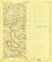
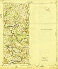
Loading map...1928 Map of Godley
USGS Topo · Published 1928About this map
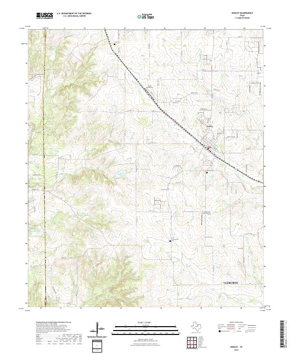
The Brazos River creates a dramatic series of deep, winding meanders across this landscape, defining the boundaries between Hood and Somervell counties. Surveyed in the mid-1920s, the map captures a rural Texas interior where transportation relied on established routes like the Fort Worth and Granbury Road and the Glenrose Road. Local life centers on a network of small schoolhouses and churches, including the Nubbin Ridge Church and schools such as Shady Grove School and Alta Vista School.
Find a feature on this map
35 named features on this map. Tap any name to fly to it.
Don’t see what you’re looking for? This feature index may not catch every label — zoom into the map to look around manually.
Map Details
Date Portrayed1928
Date Published1928
PublisherU.S. Geological Survey
Map TypeTopographic
Scale1:62,500
Physical Dimensions16.7 x 19.9 inches
Editions of this 1928 Godley Map
2 editions found
Historical Maps of Cleburne Through Time
7 maps found
Featured Locations
Source Details
SourceU.S. Geological Survey
CopyrightPublic Domain