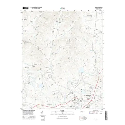
2016 Map of Godwin
USGS Topo · Published 2016About this map
Duck River meanders through the heart of Maury County, defining a landscape of dramatic bends and high ridges north of Columbia. This 2016 survey documents the complex geography where Little Bigby Creek and Rutherford Creek meet the primary river system. The terrain is marked by numerous hollows, such as Ragsdale Hollow and Taylor Hollow, which historically dictated the placement of small settlements and family burial grounds. Genealogists can find dozens of precisely located sites, including Old Knob Creek Cem, Witherspoon Cem, and the uniquely named Lasting Hope Cem.
Find a feature on this map
171 named features on this map. Tap any name to fly to it.
Don’t see what you’re looking for? This feature index may not catch every label — zoom into the map to look around manually.
Map Details
Editions of this 2016 Godwin Map
This is the sole edition of this map. No revisions or reprints were ever made.
Other maps of this area

1901 · Colombia
USGS Topo · 1:125,000

1909 · Franklin
USGS Topo · 1:62,500

1936 · Godwin
USGS Topo · 1:24,000

1936 · Williamsport
USGS Topo · 1:24,000

1936 · Primm
USGS Topo · 1:24,000

1936 · Spring Hill
USGS Topo · 1:24,000

1936 · Theta
USGS Topo · 1:24,000

1936 · Carters Creek
USGS Topo · 1:24,000

1936 · Mount Pleasant
USGS Topo · 1:24,000

1936 · Glendale
USGS Topo · 1:24,000