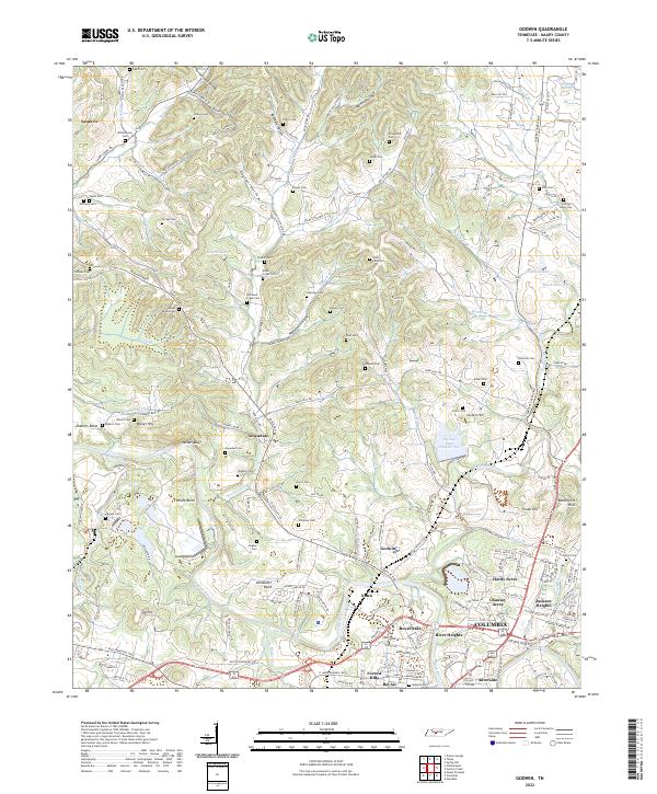
2022 Map of Godwin
USGS Topo · Published 2022About this map
Duck River carves a deep path through northern Maury County, defining a landscape of sharp ridges and secluded hollows like Sutherland Hollow and Taylor Hollow. The community of Godwin sits near the river's edge, surrounded by family-named landmarks and historical burial sites including Witherspoon Cem and Dodson Cem. Traces of the region's industrial footprint are evident south of Athendale near Tailings Pond Number Ten and along the Old TVA Mine Rd.
Find a feature on this map
185 named features on this map. Tap any name to fly to it.
Don’t see what you’re looking for? This feature index may not catch every label — zoom into the map to look around manually.
Map Details
Editions of this 2022 Godwin Map
This is the sole edition of this map. No revisions or reprints were ever made.
Other maps of this area

1901 · Colombia
USGS Topo · 1:125,000

1909 · Franklin
USGS Topo · 1:62,500

1936 · Godwin
USGS Topo · 1:24,000

1936 · Williamsport
USGS Topo · 1:24,000

1936 · Primm
USGS Topo · 1:24,000

1936 · Spring Hill
USGS Topo · 1:24,000

1936 · Theta
USGS Topo · 1:24,000

1936 · Carters Creek
USGS Topo · 1:24,000

1936 · Mount Pleasant
USGS Topo · 1:24,000

1936 · Glendale
USGS Topo · 1:24,000