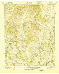
1941 Map of Godwin
USGS Topo · Published 1941About this map
Duck River meanders through the heart of Maury County, defining the landscape with deep bends like Roberts Bend and Alexander Bend. This 1941 survey, based on Tennessee Valley Authority field examinations, reveals a rural landscape dominated by family-named landmarks and small-scale industry at the dawn of the 1940s. The Louisville and Nashville railroad serves as the primary transit corridor, passing through Godwin and Natco, while the presence of Monsanto hints at the industrial development in the southwest near Lick Creek.
Find a feature on this map
65 named features on this map. Tap any name to fly to it.
Don’t see what you’re looking for? This feature index may not catch every label — zoom into the map to look around manually.
Map Details
Editions of this 1941 Godwin Map
This is the sole edition of this map. No revisions or reprints were ever made.
Other maps of this area

1901 · Colombia
USGS Topo · 1:125,000

1909 · Franklin
USGS Topo · 1:62,500

1936 · Godwin
USGS Topo · 1:24,000

1936 · Williamsport
USGS Topo · 1:24,000

1936 · Primm
USGS Topo · 1:24,000

1936 · Spring Hill
USGS Topo · 1:24,000

1936 · Theta
USGS Topo · 1:24,000

1936 · Carters Creek
USGS Topo · 1:24,000

1936 · Mount Pleasant
USGS Topo · 1:24,000

1936 · Glendale
USGS Topo · 1:24,000