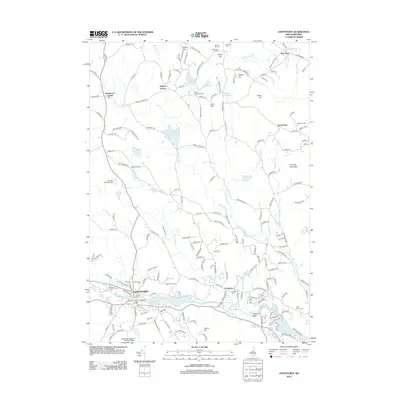
2012 Map of Goffstown
USGS Topo · Published 2012About this map
The Piscataquog River flows through the heart of Goffstown, a landscape shaped by early industrial water power and a mix of agricultural and residential development. This early 21st-century documentation captures the enduring structural history of the area, notably the Goffstown Covered Railroad Bridge and the sprawling Hillsborough County Farm near Grasmere. Genealogists will find a wealth of burial sites including Westlawn Cem, Hillside Cem, and several smaller family or community plots like Hammond Cem and Goodhue Cem in the northern reaches. The terrain transitions from the river valley to prominent heights such as Quimby Mountain and Yacum Hill, while small aviation interests are represented by the Country Club Air Park. The map also details the rail-side legacy at Greggs Falls and the scattered rural crossroads of Baileys Corner and Dunbarton Center.
Find a feature on this map
194 named features on this map. Tap any name to fly to it.
Don’t see what you’re looking for? This feature index may not catch every label — zoom into the map to look around manually.
Map Details
Editions of this 2012 Goffstown Map
This is the sole edition of this map. No revisions or reprints were ever made.
Other maps of this area

1905 · Manchester
USGS Topo · 1:62,500

1906 · Milford
USGS Topo · 1:62,500

1921 · Suncook
USGS Topo · 1:62,500

1927 · Concord
USGS Topo · 1:62,500

1941 · Manchester
USGS Topo · 1:62,500

1943 · Lowell
USGS Topo · 1:125,000

1943 · Fitchburg
USGS Topo · 1:125,000

1944 · Suncook
USGS Topo · 1:62,500

1948 · Boston
USGS Topo · 1:250,000

1949 · Portland
USGS Topo · 1:250,000