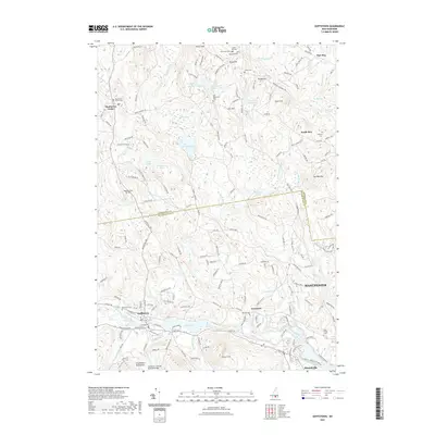
2021 Map of Goffstown
USGS Topo · Published 2021About this map
The Piscataquog River carves through the southern landscape of this New Hampshire survey, anchoring the village of Goffstown and the settlement at Grasmere. A notable historical landmark, the Goffstown Covered Railroad Bridge, remains a focal point along the river's edge, reflecting the region's transportation heritage. To the north, the terrain rises toward the Uncanoonuc Mountains and Quimby Mtn, while a network of cemeteries including Westlawn Cem and East Dunbarton Cem provide significant genealogical touchstones for the surrounding communities of Dunbarton Center and South Bow.
Find a feature on this map
179 named features on this map. Tap any name to fly to it.
Don’t see what you’re looking for? This feature index may not catch every label — zoom into the map to look around manually.
Map Details
Editions of this 2021 Goffstown Map
This is the sole edition of this map. No revisions or reprints were ever made.
Other maps of this area

1905 · Manchester
USGS Topo · 1:62,500

1906 · Milford
USGS Topo · 1:62,500

1921 · Suncook
USGS Topo · 1:62,500

1927 · Concord
USGS Topo · 1:62,500

1941 · Manchester
USGS Topo · 1:62,500

1943 · Lowell
USGS Topo · 1:125,000

1943 · Fitchburg
USGS Topo · 1:125,000

1944 · Suncook
USGS Topo · 1:62,500

1948 · Boston
USGS Topo · 1:250,000

1949 · Portland
USGS Topo · 1:250,000