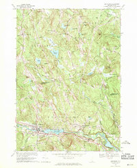
1969 Map of Goffstown
USGS Topo · Published 1971About this map
Goffstown and the village of Grasmere anchor this late-1960s landscape, where the Piscataquog River is impounded at Glen Lake. The region is defined by its transition from industrial riverfront to upland hill farms, with the Maine Central and Boston and Maine Railroad corridor following the southern bank of the river. Local infrastructure is well-documented, including the Moore General Hospital, the County Home, and several educational and municipal landmarks like the High Sch.
Find a feature on this map
86 named features on this map. Tap any name to fly to it.
Don’t see what you’re looking for? This feature index may not catch every label — zoom into the map to look around manually.
Map Details
Editions of this 1969 Goffstown Map
Other maps of this area

1905 · Manchester
USGS Topo · 1:62,500

1906 · Milford
USGS Topo · 1:62,500

1921 · Suncook
USGS Topo · 1:62,500

1927 · Concord
USGS Topo · 1:62,500

1941 · Manchester
USGS Topo · 1:62,500

1943 · Lowell
USGS Topo · 1:125,000

1943 · Fitchburg
USGS Topo · 1:125,000

1944 · Suncook
USGS Topo · 1:62,500

1948 · Boston
USGS Topo · 1:250,000

1949 · Portland
USGS Topo · 1:250,000