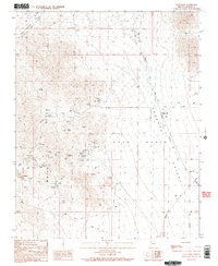
1989 Map of Gold Basin
USGS Topo · Published 1990About this map
The White Hills dominate this section of the Arizona desert, marked by an intense density of mineral exploration and extraction. The landscape is a network of Mines, Prospects, and Adits, reflecting a period when the earth was actively scoured for wealth. Distinct operations such as the Cyclopic Mine and the Excelsior Mine stand out among the countless unnamed shafts and pits, while the Open Pit Mine near Uslm 2518 illustrates more extensive surface workings.
Find a feature on this map
34 named features on this map. Tap any name to fly to it.
Don’t see what you’re looking for? This feature index may not catch every label — zoom into the map to look around manually.
Map Details
Editions of this 1989 Gold Basin Map
2 editions found
Other maps of this area

1886 · Camp Mohave
USGS Topo · 1:250,000

1892 · Camp Mohave
USGS Topo · 1:250,000

1942 · Camp Mohave
USGS Topo · 1:250,000

1947 · Kingman
USGS Topo · 1:250,000

1948 · Kingman
USGS Topo · 1:250,000

1954 · Kingman
USGS Topo · 1:250,000

1955 · Kingman
USGS Topo · 1:250,000

1958 · Kingman
USGS Topo · 1:250,000

1960 · Kingman
USGS Topo · 1:250,000
1960 · Senator Mountain
USGS Topo · 1:62,500