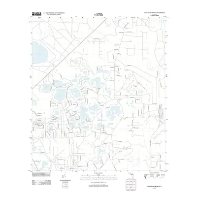
2012 Map of Gold Head Branch
USGS Topo · Published 2012About this map
White Sands Lake and a dense cluster of karst-formed basins dominate this portion of Clay County, reflecting a landscape defined by its hydrography. The area is characterized by numerous named bodies of water including Gator Bone Lake, Little Lake Johnson, and Big Lake Johnson, which serve as central landmarks for the surrounding residential road networks. This 2012 survey illustrates the transition from rural woodlands to modern developments, where roads like Blueberry Hill Rd and Golden Oak Ln weave through the lake country.
Find a feature on this map
185 named features on this map. Tap any name to fly to it.
Don’t see what you’re looking for? This feature index may not catch every label — zoom into the map to look around manually.
Map Details
Editions of this 2012 Gold Head Branch Map
This is the sole edition of this map. No revisions or reprints were ever made.
Other maps of this area

1915 · Interlachen
USGS Topo · 1:48,000

1916 · Interlachen
USGS Topo · 1:62,500

1938 · Hawthorn
USGS Topo · 1:48,000

1941 · Starke
USGS Topo · 1:62,500

1942 · Ates Creek
USGS Topo · 1:62,500

1943 · Hawthorn
USGS Topo · 1:62,500

1944 · Interlachen
USGS Topo · 1:62,500

1948 · Starke
USGS Topo · 1:50,000

1949 · Rice Creek
USGS Topo · 1:24,000

1949 · Baywood
USGS Topo · 1:24,000