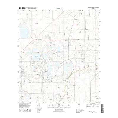
2015 Map of Gold Head Branch
USGS Topo · Published 2015About this map
Gold Head Br flows through this lake-rich portion of Florida, where the boundary between Clay Co and Putnam Co bisects the landscape. The area is defined by a dense concentration of named water bodies, including Big Lake Johnson, White Sands Lake, and the uniquely named Devils Wash Basin. These lakes, often circular and varied in size, suggest the karst topography characteristic of the region. Residential development is clustered around several of these basins, particularly near Silver Sand Lake and Lake Washington. The presence of the Gadara Cem south of Smith Lake provides a point of genealogical interest in an area otherwise dominated by recreational water features and rural road networks like Bellamy Rd. To the north, the terrain remains less developed around Lowry Lake and Sheelar Lake, maintaining the natural hydrological character of the upper peninsula.
Find a feature on this map
165 named features on this map. Tap any name to fly to it.
Don’t see what you’re looking for? This feature index may not catch every label — zoom into the map to look around manually.
Map Details
Editions of this 2015 Gold Head Branch Map
This is the sole edition of this map. No revisions or reprints were ever made.
Other maps of this area

1915 · Interlachen
USGS Topo · 1:48,000

1916 · Interlachen
USGS Topo · 1:62,500

1938 · Hawthorn
USGS Topo · 1:48,000

1941 · Starke
USGS Topo · 1:62,500

1942 · Ates Creek
USGS Topo · 1:62,500

1943 · Hawthorn
USGS Topo · 1:62,500

1944 · Interlachen
USGS Topo · 1:62,500

1948 · Starke
USGS Topo · 1:50,000

1949 · Rice Creek
USGS Topo · 1:24,000

1949 · Baywood
USGS Topo · 1:24,000