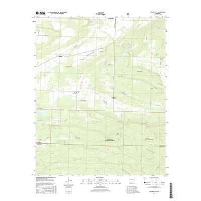
2017 Map of Golden City
USGS Topo · Published 2017About this map
Golden City and the northern reaches of the Ouachita National Forest define this landscape on the border of Logan and Scott Counties. The terrain transitions from the low-lying valley of the Petit Jean River and Greasy Creek in the north to the significant elevations of Buck Knob and Huckleberry Mountain in the south. This 2017 data reflects a long-established rural settlement pattern where family and community heritage is preserved in numerous burial grounds, including Hamby Cemetery, Hopewell Cemetery, and Mixon Cemetery. The road network, featuring routes like Carolan Road and Jack Creek Road, connects small communities such as Carolan and Mixon to the surrounding timberlands and river bottoms, illustrating the enduring agricultural and forest-based character of this Arkansas region.
Find a feature on this map
64 named features on this map. Tap any name to fly to it.
Don’t see what you’re looking for? This feature index may not catch every label — zoom into the map to look around manually.
Map Details
Editions of this 2017 Golden City Map
This is the sole edition of this map. No revisions or reprints were ever made.
Other maps of this area

1879 · Poteau Mountain
USGS Topo · 1:62,500

1887 · Poteau Mountain #1
USGS Topo · 1:62,500

1887 · Mount Ida #2
USGS Topo · 1:62,500

1887 · Magazine Mountain #3
USGS Topo · 1:62,500

1887 · Magazine Mountain
USGS Topo · 1:62,500

1890 · Magazine Mountain
USGS Topo · 1:125,000

1890 · Mount Ida
USGS Topo · 1:125,000

1890 · Fort Smith
USGS Topo · 1:125,000

1890 · Poteau Mountain
USGS Topo · 1:125,000

1899 · Poteau Mountain
USGS Topo · 1:125,000