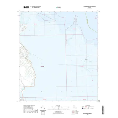
2020 Map of Golden Meadow Farms
USGS Topo · Published 2020About this map
Golden Meadow Farms sits within a complex network of coastal wetlands and waterways at the border of Jefferson and Lafourche Parishes. This 2020 survey illustrates a landscape dominated by the intricate hydrology of the Mississippi River delta, where the land is defined more by its named bayous and lakes than by terrestrial landmarks. The movement of water through the West Fork and East Fork Bayou L'Ours reveals the natural drainage patterns of the marsh, while family and local names like John the Fool Bayou and Kings Ridge anchor the geography.
Find a feature on this map
18 named features on this map. Tap any name to fly to it.
Don’t see what you’re looking for? This feature index may not catch every label — zoom into the map to look around manually.
Map Details
Editions of this 2020 Golden Meadow Farms Map
This is the sole edition of this map. No revisions or reprints were ever made.
Other maps of this area

1892 · Barataria
USGS Topo · 1:62,500

1892 · Cut-Off
USGS Topo · 1:62,500

1892 · Creole
USGS Topo · 1:62,500

1894 · Lake Felicity
USGS Topo · 1:62,500

1935 · Bay Courant
USGS Topo · 1:31,680

1935 · Golden Meadow
USGS Topo · 1:31,680

1935 · Mink Bayou
USGS Topo · 1:31,680

1939 · Cut-Off
USGS Topo · 1:62,500

1939 · Lake Felicity
USGS Topo · 1:62,500

1941 · Cut-Off
USGS Topo · 1:62,500