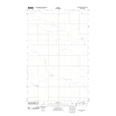
2011 Map of Goldstone SW
USGS Topo · Published 2011About this map
Sage Creek and Little Sage Creek meander across this section of Hill County, defining a landscape shaped by intermittent water and agricultural management. The map highlights specific water control points such as Ostrich Egg Dam and Gritty Milk Dam, features that point to the localized water engineering necessary for ranching and farming in this part of Montana. The layout is dominated by a systematic grid of section lines and secondary transport routes, notably Inverness Rd, which serves as a primary north-south artery through the open country. This 2011 survey captures the area's modern topography while preserving the names of specific drainage basins and local landmarks that help define the character of the High Line region.
Find a feature on this map
6 named features on this map. Tap any name to fly to it.
Don’t see what you’re looking for? This feature index may not catch every label — zoom into the map to look around manually.
Map Details
Editions of this 2011 Goldstone SW Map
This is the sole edition of this map. No revisions or reprints were ever made.
Other maps of this area

1919 · Alma
USGS Topo · 1:125,000

1954 · Shelby
USGS Topo · 1:250,000

1958 · Shelby
USGS Topo · 1:250,000

1963 · Bobcat Coulee SE
USGS Topo · 1:24,000

1963 · Chester NE
USGS Topo · 1:24,000
1964 · Bobcat Coulee NE
USGS Topo · 1:24,000

1972 · Goldstone SW
USGS Topo · 1:24,000

1972 · Rudyard NW
USGS Topo · 1:24,000

1972 · Mc Kinnsey Reservoir West
USGS Topo · 1:24,000
1972 · Goldstone
USGS Topo · 1:24,000