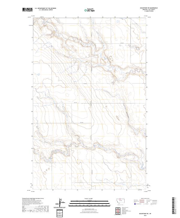
2024 Map of Goldstone SW
USGS Topo · Published 2024About this map
Sage Creek meanders through the northern section of this high plains landscape, defining the local drainage system alongside the southern flow of Little Sage Creek. The area is characterized by a sparse, grid-like road network essential for modern agricultural access, including Inverness Rd and various numbered routes like Rd 180 N. This 2024 survey illustrates the persistence of early land divisions, with township and range lines like t36n r8e and t35n r8e providing the structural framework for the remote Montana terrain. Erosion patterns are most evident along Miranda Coulee in the east, where the landscape drops away from the level plateaus, revealing the intricate coulee systems that define the geography of Hill County.
Find a feature on this map
10 named features on this map. Tap any name to fly to it.
Don’t see what you’re looking for? This feature index may not catch every label — zoom into the map to look around manually.
Map Details
Editions of this 2024 Goldstone SW Map
This is the sole edition of this map. No revisions or reprints were ever made.
Other maps of this area

1919 · Alma
USGS Topo · 1:125,000

1954 · Shelby
USGS Topo · 1:250,000

1958 · Shelby
USGS Topo · 1:250,000

1963 · Bobcat Coulee SE
USGS Topo · 1:24,000

1963 · Chester NE
USGS Topo · 1:24,000
1964 · Bobcat Coulee NE
USGS Topo · 1:24,000

1972 · Goldstone SW
USGS Topo · 1:24,000

1972 · Rudyard NW
USGS Topo · 1:24,000

1972 · Mc Kinnsey Reservoir West
USGS Topo · 1:24,000
1972 · Goldstone
USGS Topo · 1:24,000