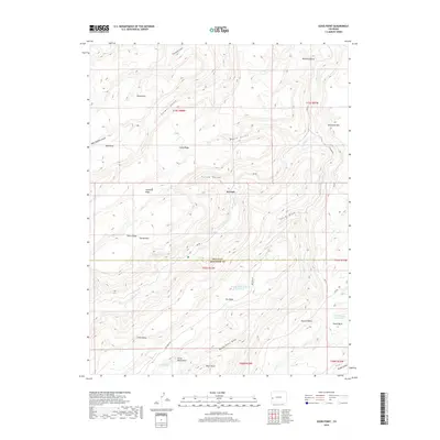
2019 Map of Good Point
USGS Topo · Published 2019About this map
The high plateau country of western Colorado is defined by a series of distinct mesas and deeply carved gulches straddling the line between Delta and Montrose counties. This landscape is marked by the drainages of Escalante Creek and its Dry Fork, which wind through topographic features like McCarty Bench and Escalante Rim. Strategic water sources were essential for ranching and land use in this arid environment, evidenced by scattered points like Cottonwood Spring, Cave Spring, and Alum Spring.
Find a feature on this map
42 named features on this map. Tap any name to fly to it.
Don’t see what you’re looking for? This feature index may not catch every label — zoom into the map to look around manually.
Map Details
Editions of this 2019 Good Point Map
This is the sole edition of this map. No revisions or reprints were ever made.
Other maps of this area
1956 · Moab
USGS Topo · 1:250,000
1959 · Moab
USGS Topo · 1:250,000
1960 · Moab
USGS Topo · 1:250,000
1962 · Moab
USGS Topo · 1:250,000
1964 · Moab
USGS Topo · 1:250,000
1965 · Moab
USGS Topo · 1:250,000
1965 · Point Creek
USGS Topo · 1:24,000
1969 · Roubideau
USGS Topo · 1:24,000
1969 · Triangle Mesa
USGS Topo · 1:24,000
1969 · Dominguez
USGS Topo · 1:24,000