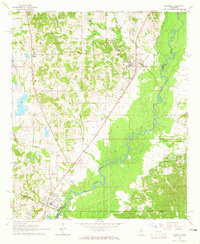
1964 Map of Goodman
USGS Topo · Published 1965About this map
Goodman and Pickens serve as the primary hubs in this mid-1960s study of the Mississippi heartland, where the Illinois Central railroad dictates the local geometry of commerce and travel. The landscape is defined by the winding course of the Big Black River, which forms the natural boundary between several counties and creates a lush, alluvial basin that contrasts with the surrounding upland terrain.
Find a feature on this map
28 named features on this map. Tap any name to fly to it.
Don’t see what you’re looking for? This feature index may not catch every label — zoom into the map to look around manually.
Map Details
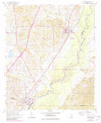
Editions of this 1964 Goodman Map
2 editions found
Other maps of this area

1940 · Lexington
USGS Topo · 1:62,500

1953 · Meridian
USGS Topo · 1:250,000

1953 · Greenwood
USGS Topo · 1:250,000

1953 · West Point
USGS Topo · 1:250,000

1955 · Jackson
USGS Topo · 1:250,000

1956 · Greenwood
USGS Topo · 1:250,000

1957 · Meridian
USGS Topo · 1:250,000

1957 · Lexington
USGS Topo · 1:62,500

1958 · West Point
USGS Topo · 1:250,000

1958 · Lexington
USGS Topo · 1:62,500