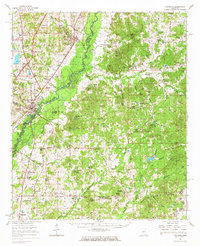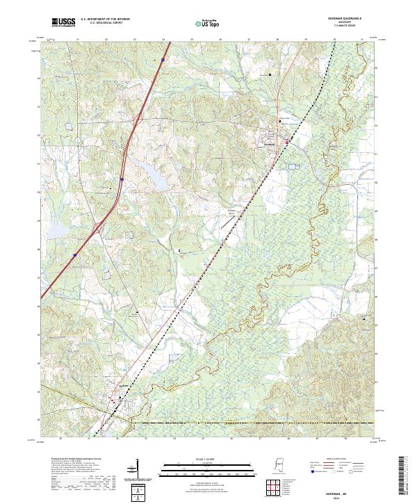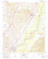
1964 Map of Goodman
USGS Topo · Published 1982About this map
Goodman and Pickens anchor this 1964 survey of the central Mississippi landscape, where the Illinois Central Gulf railroad serves as the primary corridor for commerce and movement. The campus of Holmes Jr College sits prominently on the eastern edge of Goodman, reflecting the town's role as an educational hub. To the south, the meandering course of the Big Black River forms a significant natural boundary, separating Holmes Co, Attala Co, Yazoo Co, and Madison Co. This riverine environment is defined by low-lying oxbows and tributaries like Seneasha Creek and Tacketts Creek. Rural life is evidenced by a network of local landmarks, including St Marys Ch, Bethlehem Ch, and the isolated Presley Landing Strip, providing a clear view of the area's mid-century layout before modern infrastructure changes.
Find a feature on this map
28 named features on this map. Tap any name to fly to it.
Don’t see what you’re looking for? This feature index may not catch every label — zoom into the map to look around manually.
Map Details
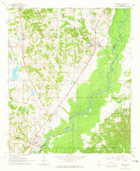
Editions of this 1964 Goodman Map
2 editions found
Historical Maps of Pickens Through Time
7 maps found