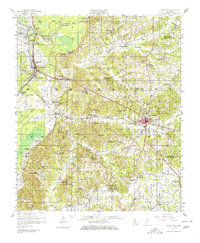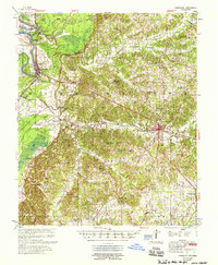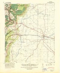
1940 Map of Lexington
USGS Topo · Published 1945About this map
The Yazoo River and its ancient floodplain dominate the western edge of this 1940s landscape, where a sharp escarpment separates the river bottomlands from the higher terrain of Holmes County. The town of Lexington serves as the focal point for a network of rural roads and rails, including the (Y & M V) RR and the Mississippi Central RR. The map reveals a deeply established social infrastructure, marked by numerous small community centers such as Eulogy, Tolarsville, and Brozville.
Find a feature on this map
47 named features on this map. Tap any name to fly to it.
Don’t see what you’re looking for? This feature index may not catch every label — zoom into the map to look around manually.
Map Details
Editions of this 1940 Lexington Map
This is the sole edition of this map. No revisions or reprints were ever made.
Historical Maps of Tchula Through Time
3 maps found