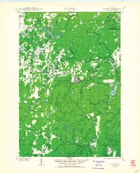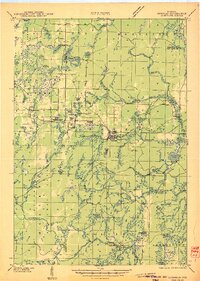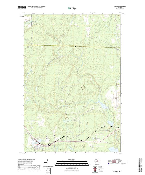
1972 Map of Goodman
USGS Topo · Published 1974About this map
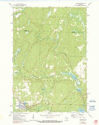
The timber and rail town of Goodman anchors this 1970s survey, showing the established settlement at the junction of the Soo Line railroad and local waters. The industrial character of the town is evident through the Goodman Millpond and the presence of a Sewage Disp facility, while the community's history is preserved at Glenwood Cem. Surrounding the townsite, a complex network of waterways including the Pine River, Sidney Creek, and Skinner Branch illustrates the drainage of the North Woods, punctuated by features like Scott Dam and Railroad Pond. The map also traces the remnants of former transport routes, marked as an Old Grade, which suggests the legacy of logging operations that once moved through this corner of Marinette County. From the northern edge of Homestead to the southern shores of Moon Lake, the landscape is defined by its transition from industrial processing to a wetland and lake system.
Find a feature on this map
28 named features on this map. Tap any name to fly to it.
Don’t see what you’re looking for? This feature index may not catch every label — zoom into the map to look around manually.
Map Details
Editions of this 1972 Goodman Map
2 editions found
Historical Maps of Goodman Through Time
8 maps found