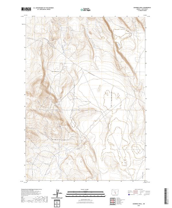
2023 Map of Goodrich Well
USGS Topo · Published 2023About this map
The high desert landscape of Lake County is defined by the expansive Alkali Valley, which dominates the southeastern quadrant of this region. This modern survey illustrates the critical transportation arteries that cross this open terrain, specifically where the Christmas Valley Hwy meets the historic route of the Christmas Valley Wagontire Rd. These roads suggest a long-standing network of travel through the basin, connecting remote points in the Oregon interior. The topography is marked by significant elevation changes that transition into the valley floor, overseen by the Bureau of Land Management as evidenced by the network of access routes like BLM Rd 6111-0-00. The map serves as a contemporary record of public land management and the enduring infrastructure of the high desert corridor.
Find a feature on this map
10 named features on this map. Tap any name to fly to it.
Don’t see what you’re looking for? This feature index may not catch every label — zoom into the map to look around manually.
Map Details
Editions of this 2023 Goodrich Well Map
This is the sole edition of this map. No revisions or reprints were ever made.
Other maps of this area

1955 · Crescent
USGS Topo · 1:250,000

1955 · Burns
USGS Topo · 1:250,000

1957 · Crescent
USGS Topo · 1:250,000

1958 · Crescent
USGS Topo · 1:250,000

1958 · Burns
USGS Topo · 1:250,000

1959 · Burns
USGS Topo · 1:250,000

1970 · Crescent
USGS Topo · 1:250,000

1980 · Wagontire Mtn West
USGS Topo · 1:24,000

1981 · Elk Butte
USGS Topo · 1:24,000
1981 · Rams Butte
USGS Topo · 1:24,000