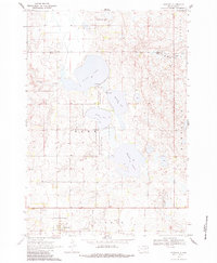
1970 Map of Goodwin
USGS Topo · Published 1983About this map
Goodwin anchors the southern portion of this 1970 field-checked survey, serving as a focal point for the surrounding prairie landscape in Deuel County. The region is defined by a series of significant water bodies, including Round Lake, Bullhead Lake, and Wigdale Lake, which provide a natural structure to the township divisions of Troy and Rome. An Old Railroad Grade cuts across the lower terrain, offering a clear trace of the area's former transportation network and rail-based economy.
Find a feature on this map
24 named features on this map. Tap any name to fly to it.
Don’t see what you’re looking for? This feature index may not catch every label — zoom into the map to look around manually.
Map Details
Editions of this 1970 Goodwin Map
2 editions found
Other maps of this area

1953 · Milbank
USGS Topo · 1:250,000

1953 · Watertown
USGS Topo · 1:250,000

1958 · Milbank
USGS Topo · 1:250,000

1958 · Watertown
USGS Topo · 1:250,000

1970 · Kranzburg SW
USGS Topo · 1:24,000

1970 · Kranzburg
USGS Topo · 1:24,000

1970 · Bemis
USGS Topo · 1:24,000

1970 · Goodwin
USGS Topo · 1:24,000

1973 · LaBolt
USGS Topo · 1:24,000

1973 · Tunerville
USGS Topo · 1:24,000