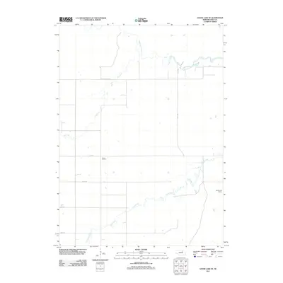
2011 Map of Goose Lake NE
USGS Topo · Published 2011About this map
South Fork Elkhorn River winds across this rural section of Holt County, defining a landscape shaped by its watercourses and a strict grid of section roads. The terrain is characterized by the meandering paths of Dry Creek and Cache Creek, which flow through the prairie alongside a network of local routes including 851st Rd and 498th Ave. A notable landmark for family history researchers is the Trussel Cemetery, located centrally among the agricultural fields. Toward the eastern edge, the presence of the Vandersnick Airport indicates the continued importance of regional aviation in this expansive Nebraska landscape. This 2011 edition provides a clear record of the area's rural infrastructure, from the naming of minor county roads to the exact paths of seasonal drainage.
Find a feature on this map
13 named features on this map. Tap any name to fly to it.
Don’t see what you’re looking for? This feature index may not catch every label — zoom into the map to look around manually.
Map Details
Editions of this 2011 Goose Lake NE Map
This is the sole edition of this map. No revisions or reprints were ever made.
Other maps of this area

1955 · O'Neill
USGS Topo · 1:250,000

1959 · O'Neill
USGS Topo · 1:250,000

1963 · Ewing SW
USGS Topo · 1:24,000

1963 · Deloit SW
USGS Topo · 1:24,000

1963 · Deloit NW
USGS Topo · 1:24,000

1964 · O'Neill SE
USGS Topo · 1:24,000

1964 · O'Neill SW
USGS Topo · 1:24,000

1969 · O'Neill
USGS Topo · 1:250,000

1981 · Goose Lake SW
USGS Topo · 1:24,000

1981 · Chambers East
USGS Topo · 1:24,000