
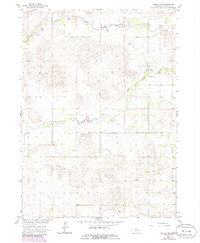
1963 Map of Deloit NW
USGS Topo · Published 1964About this map
The South Fork Elkhorn River winds through the northern portion of this Nebraska landscape, where the township boundaries of McClure, Ewing, Lake, and Deloit meet. This early 1960s survey reveals a rural territory defined by its watercourses and small-scale industry, including the Claypits located along the river's edge. Local education and community life are anchored by the Cache Creek Valley Sch near the central waterway of Cache Creek. Genealogists and historians will find significant localized landmarks such as Vandersnick Cem and the Hubel Airfield, providing a detailed look at the infrastructure and burial grounds serving these remote prairie townships before modern consolidation changed the rural school and transportation network.
Find a feature on this map
11 named features on this map. Tap any name to fly to it.
Don’t see what you’re looking for? This feature index may not catch every label — zoom into the map to look around manually.
Map Details
Editions of this 1963 Deloit NW Map
2 editions found
Other maps of this area

1955 · O'Neill
USGS Topo · 1:250,000

1959 · O'Neill
USGS Topo · 1:250,000

1963 · Deloit
USGS Topo · 1:24,000

1963 · Ewing SW
USGS Topo · 1:24,000

1963 · Deloit SW
USGS Topo · 1:24,000

1963 · Ewing
USGS Topo · 1:24,000

1963 · Deloit NE
USGS Topo · 1:24,000

1964 · O'Neill SE
USGS Topo · 1:24,000

1969 · O'Neill
USGS Topo · 1:250,000
1981 · Goose Lake NE
USGS Topo · 1:24,000