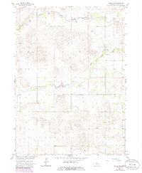
1963 Map of Deloit NW
USGS Topo · Published 1986About this map
The South Fork Elkhorn River meanders through the northern reaches of this Holt County landscape, defining a riparian corridor that contrasts with the surrounding plains. Traces of early rural community life are centered near the smaller Cache Creek drainage, which flows eastward through the center of the survey. Educational and local history is anchored by the Cache Creek Valley Sch and the Vandersnick Cem, sites that represent the focal points for the area's dispersed agricultural population. A modest industrial presence is noted at the Claypit in the northwest, while a small Landing Strip suggests the transition toward modern aerial utility in this Nebraska countryside. Revised in the mid-1980s from original 1960s data, the map details a landscape defined by the drainage patterns of the Elkhorn and its tributaries.
Find a feature on this map
6 named features on this map. Tap any name to fly to it.
Don’t see what you’re looking for? This feature index may not catch every label — zoom into the map to look around manually.
Map Details
Editions of this 1963 Deloit NW Map
2 editions found
Other maps of this area

1955 · O'Neill
USGS Topo · 1:250,000

1959 · O'Neill
USGS Topo · 1:250,000

1963 · Deloit
USGS Topo · 1:24,000

1963 · Ewing SW
USGS Topo · 1:24,000

1963 · Deloit SW
USGS Topo · 1:24,000

1963 · Ewing
USGS Topo · 1:24,000

1963 · Deloit NE
USGS Topo · 1:24,000

1963 · Deloit NW
USGS Topo · 1:24,000

1964 · O'Neill SE
USGS Topo · 1:24,000

1969 · O'Neill
USGS Topo · 1:250,000