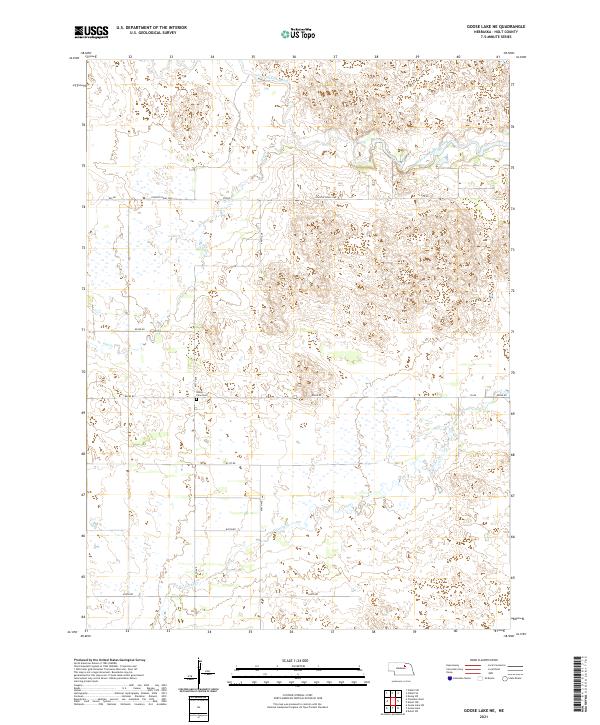
2021 Map of Goose Lake NE
USGS Topo · Published 2021About this map
Valley View Cem stands as a quiet focal point in this section of Holt County, situated south of the braided channels of the South Fork Elkhorn River. The landscape is defined by the gentle drainage patterns of the S Fork Elkhorn River in the north and Cache Cr to the south, reflecting the agrarian character of this Nebraska plains region. A systematic grid of section roads, such as Country Road 2260 and 852nd Rd, provides access across the township lines of t26n r11w and t25n r11w. This 2021 survey illustrates a sparse settlement pattern common in the Sandhills transition zone, where land use is dictated by the availability of water from seasonal drainages like Dry Cr. The continuity of small family cemeteries and the preservation of section line routes offer researchers clear markers of the long-standing agricultural boundaries established generations ago.
Find a feature on this map
19 named features on this map. Tap any name to fly to it.
Don’t see what you’re looking for? This feature index may not catch every label — zoom into the map to look around manually.
Map Details
Editions of this 2021 Goose Lake NE Map
This is the sole edition of this map. No revisions or reprints were ever made.
Other maps of this area

1955 · O'Neill
USGS Topo · 1:250,000

1959 · O'Neill
USGS Topo · 1:250,000

1963 · Ewing SW
USGS Topo · 1:24,000

1963 · Deloit SW
USGS Topo · 1:24,000

1963 · Deloit NW
USGS Topo · 1:24,000

1964 · O'Neill SE
USGS Topo · 1:24,000

1964 · O'Neill SW
USGS Topo · 1:24,000

1969 · O'Neill
USGS Topo · 1:250,000

1981 · Goose Lake SW
USGS Topo · 1:24,000

1981 · Chambers East
USGS Topo · 1:24,000