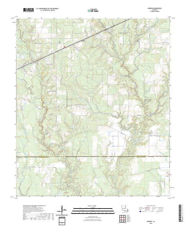
2024 Map of Gordon
USGS Topo · Published 2024About this map
The settlement of Gordon serves as a focal point in this portion of Southwest Louisiana, situated at the junction of Old Inland Mill Rd and Highway 12. The landscape is defined by the complex drainage systems of Tiger Glade Creek and Beckwith Creek, which weave through the timberlands and wetlands characteristic of the region.
Find a feature on this map
55 named features on this map. Tap any name to fly to it.
Don’t see what you’re looking for? This feature index may not catch every label — zoom into the map to look around manually.
Map Details
Editions of this 2024 Gordon Map
This is the sole edition of this map. No revisions or reprints were ever made.
Other maps of this area

1935 · Buhler
USGS Topo · 1:31,680

1935 · Moss Bluff
USGS Topo · 1:31,680

1935 · Gordon
USGS Topo · 1:31,680

1935 · Gaytine
USGS Topo · 1:31,680

1935 · Longville
USGS Topo · 1:31,680

1947 · Gaytine
USGS Topo · 1:31,680

1947 · Moss Bluff
USGS Topo · 1:31,680

1947 · DeQuincy
USGS Topo · 1:31,680

1947 · Sulphur Mines
USGS Topo · 1:31,680

1947 · Oretta
USGS Topo · 1:31,680