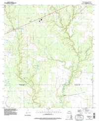
1994 Map of Gordon
USGS Topo · Published 1996About this map
Gordon and the surrounding piney lowlands of the Beauregard Parish and Calcasieu Parish border are documented here following 1994 revisions. The landscape is defined by an intricate network of waterways, including Beckwith Creek, Tiger Glade, and Cowpen Creek, which wind through the terrain toward the southern Little River. Human activity is marked by the presence of a central Oil and Gas Field and a significant Lookout Tower near the northern boundary. Genealogists will find value in the specific locations of Gillie Cem and Alston Cem, while recreational history is noted at the Boy Scout Camp situated along the creek bends. Industrial infrastructure, including a Pumping Station and the Hickory Branch Canal, reflects the managed water and resource extraction of the late 20th century.
Find a feature on this map
22 named features on this map. Tap any name to fly to it.
Don’t see what you’re looking for? This feature index may not catch every label — zoom into the map to look around manually.
Map Details
Editions of this 1994 Gordon Map
This is the sole edition of this map. No revisions or reprints were ever made.
Other maps of this area

1935 · Buhler
USGS Topo · 1:31,680

1935 · Moss Bluff
USGS Topo · 1:31,680

1935 · Gordon
USGS Topo · 1:31,680

1935 · Gaytine
USGS Topo · 1:31,680

1935 · Longville
USGS Topo · 1:31,680

1947 · Gaytine
USGS Topo · 1:31,680

1947 · Moss Bluff
USGS Topo · 1:31,680

1947 · DeQuincy
USGS Topo · 1:31,680

1947 · Sulphur Mines
USGS Topo · 1:31,680

1947 · Oretta
USGS Topo · 1:31,680