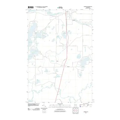
2010 Map of Gordon
USGS Topo · Published 2010About this map
The Saint Croix River and Totagatic River define this Northwoods landscape, where the confluence of major waterways shaped the early settlements of Gordon and Wascott. At the northern edge, the Gordon 2WP49 Dam regulates the Saint Croix Flowage, a significant water body created at the junction with the Eau Claire River. The interior is densely pocketed with glacial lakes, from the large Sullivan Lake in the east to the western chain including Bardon Lake, Bond Lake, and Leader Lake. This 2010 survey illustrates a region where the traditional north-south travel corridor, now followed by modern roads, remains central to the community's layout. Local history is anchored by the Wascott Cemetery and numerous family-named landmarks like Yoekel Lake and Peterson Lake, reflecting a long-standing relationship between the residents and the surrounding water and timber resources.
Find a feature on this map
69 named features on this map. Tap any name to fly to it.
Don’t see what you’re looking for? This feature index may not catch every label — zoom into the map to look around manually.
Map Details
Editions of this 2010 Gordon Map
This is the sole edition of this map. No revisions or reprints were ever made.
Other maps of this area

1945 · Highland
USGS Topo · 1:48,000

1945 · Solon Springs
USGS Topo · 1:48,000

1947 · Chittamo
USGS Topo · 1:48,000

1947 · Minong
USGS Topo · 1:48,000

1949 · Solon Springs
USGS Topo · 1:48,000

1949 · Chittamo
USGS Topo · 1:48,000

1949 · Minong
USGS Topo · 1:48,000

1949 · Highland
USGS Topo · 1:48,000

1953 · Ashland
USGS Topo · 1:250,000

1958 · Ashland
USGS Topo · 1:250,000