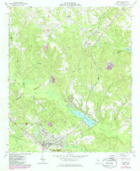
1973 Map of Gordon
USGS Topo · Published 1985About this map
The Central of Georgia railroad corridor anchors this mid-Georgia landscape, connecting the industrial operations of Gordon and Stevens Pottery to the wider region. In the early 1970s, the area's economy is clearly defined by natural resource extraction, evidenced by several sandpits and a large claypit north of Gordon. The town of Gordon itself is well-developed for the era, featuring a hospital, a large school system, and the Radio Tower (WKOG) overlooking the residential streets.
Find a feature on this map
45 named features on this map. Tap any name to fly to it.
Don’t see what you’re looking for? This feature index may not catch every label — zoom into the map to look around manually.
Map Details
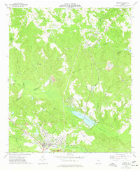
Editions of this 1973 Gordon Map
2 editions found
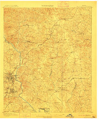
Other maps of this area
1912 · Milledgeville
USGS Topo · 1:62,500

1916 · Irwinton
USGS Topo · 1:62,500

1920 · Irwinton
USGS Topo · 1:62,500

1953 · Athens
USGS Topo · 1:250,000
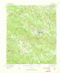
1956 · Gordon
USGS Topo · 1:62,500

1957 · Macon
USGS Topo · 1:250,000

1958 · Macon
USGS Topo · 1:250,000

1958 · Athens
USGS Topo · 1:250,000

1959 · Athens
USGS Topo · 1:250,000

1963 · Athens
USGS Topo · 1:250,000