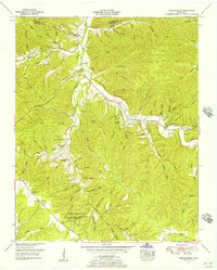
1951 Map of Gordonsburg
USGS Topo · Published 1957About this map
Meriwether Lewis National Monument anchors the southern portion of this 1951 topographic study, marking the site along the Natchez Trace where the famed explorer met his end. The landscape is a dense network of ridges and hollows, such as Lindsey Ridge and Sweet Hollow, which dictate the scattered settlement patterns of the era. The industrial character of the region is evident through the numerous phosphate mines clustered near Gordonsburg, reflecting the importance of mineral extraction to the local economy.
Find a feature on this map
79 named features on this map. Tap any name to fly to it.
Don’t see what you’re looking for? This feature index may not catch every label — zoom into the map to look around manually.
Map Details
Editions of this 1951 Gordonsburg Map
2 editions found
Other maps of this area

1901 · Colombia
USGS Topo · 1:125,000

1905 · Waynesboro
USGS Topo · 1:125,000

1936 · Riverside
USGS Topo · 1:24,000

1936 · Mt Joy
USGS Topo · 1:24,000

1936 · Beaverdam Springs
USGS Topo · 1:24,000

1936 · Henryville
USGS Topo · 1:24,000

1936 · Sunrise
USGS Topo · 1:24,000

1936 · Crestview
USGS Topo · 1:24,000

1936 · Greenfield Bend
USGS Topo · 1:24,000

1936 · Kimmins
USGS Topo · 1:24,000