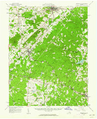
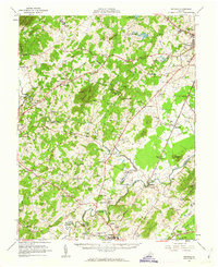
1977 Map of Gordonsville
USGS Topo · Published 1982About this map
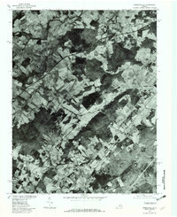
Gordonsville anchors this orthophotograph, where the agricultural patterns of central Virginia meet the rising terrain of the Piedmont. Captured in the late 1970s, the imagery reveals a landscape of working farms and timbered ridges, with the town's historic street grid and rail corridors clearly visible. The drainage of the South Anna River begins its course here, while to the north, the Rapidan River and Blue Run define the low-lying agricultural valleys. Distinctive topographical features like Cowherd Mountain and Merry Mountain stand out as heavily forested interruptions to the open fields of Somerset and Madison Run. This period documentation, produced in cooperation with the Soil Conservation Service, provides a precise record of land use and property boundaries during a transition toward more modern rural development in Orange County.
Find a feature on this map
10 named features on this map. Tap any name to fly to it.
Don’t see what you’re looking for? This feature index may not catch every label — zoom into the map to look around manually.
Map Details
Editions of this 1977 Gordonsville Map
This is the sole edition of this map. No revisions or reprints were ever made.
Other maps of this area

1892 · Gordonsville
USGS Topo · 1:125,000

1930 · Madison
USGS Topo · 1:48,000

1933 · Madison
USGS Topo · 1:62,500

1935 · Charlottesville
USGS Topo · 1:62,500

1939 · Charlottesville
USGS Topo · 1:62,500

1949 · Charlottesville
USGS Topo · 1:250,000

1949 · Charlottesville
USGS Topo · 1:62,500

1956 · Charlottesville
USGS Topo · 1:250,000
1961 · Gordonsville
USGS Topo · 1:62,500
1961 · Rapidan
USGS Topo · 1:62,500