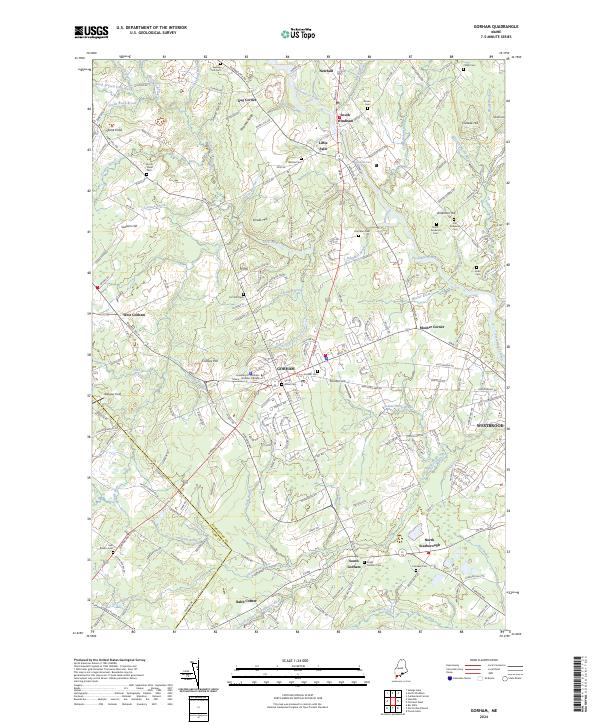
2024 Map of Gorham
USGS Topo · Published 2024About this map
Gorham serves as the central hub of this Cumberland County landscape, where the University of Southern Maine - Gorham Campus anchors the town's geography. The map reveals a high density of small burial grounds, such as Eastern Cem, Larrabee Cem, and the Smith - Anderson Cem, which reflect the deep generational roots of the surrounding countryside. This settlement pattern follows a network of brooks and rivers, most notably the Presumpscot River and the winding Stroudwater River. To the north, the terrain rises toward Pleasant Ridge and Smalls Hill, while the southern reaches transition into the lowlands near South Gorham and Babb Corner. The geography here is defined by these watercourses, with the Little River and Mosher Brook carving through a mix of established residential corridors and more open fields like Webster Field.
Find a feature on this map
185 named features on this map. Tap any name to fly to it.
Don’t see what you’re looking for? This feature index may not catch every label — zoom into the map to look around manually.
Map Details
Editions of this 2024 Gorham Map
This is the sole edition of this map. No revisions or reprints were ever made.
Other maps of this area

1891 · Portland
USGS Topo · 1:62,500

1891 · Buxton
USGS Topo · 1:62,500

1892 · Buxton
USGS Topo · 1:62,500

1893 · Portland
USGS Topo · 1:62,500

1893 · Buxton
USGS Topo · 1:62,500

1894 · Gray
USGS Topo · 1:62,500

1896 · Sebago
USGS Topo · 1:62,500

1898 · Gray
USGS Topo · 1:62,500

1914 · Portland
USGS Topo · 1:48,000

1916 · Portland
USGS Topo · 1:62,500