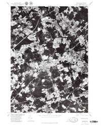
1975 Map of Gorham
USGS Topo · Published 1979About this map
Gorham serves as the central hub of this mid-1970s orthophotograph, illustrating a transitional landscape where residential expansion meets the historical agricultural fields of Cumberland County. The aerial perspective reveals a dense patchwork of woodlots and clearings, anchored by the industrial and residential centers of Westbrook and South Windham. Three distinct waterways define the drainage of this coastal plain: the winding Presumpscot River to the north, and the Stroudwater River and Nonesuch River flowing toward the Atlantic to the south. This survey, produced by the Geological Survey in cooperation with the Soil Conservation Service, documents the development patterns of North Scarborough during a period of significant regional growth.
Find a feature on this map
7 named features on this map. Tap any name to fly to it.
Don’t see what you’re looking for? This feature index may not catch every label — zoom into the map to look around manually.
Map Details
Editions of this 1975 Gorham Map
This is the sole edition of this map. No revisions or reprints were ever made.
Other maps of this area

1891 · Portland
USGS Topo · 1:62,500

1891 · Buxton
USGS Topo · 1:62,500

1892 · Buxton
USGS Topo · 1:62,500

1893 · Portland
USGS Topo · 1:62,500

1893 · Buxton
USGS Topo · 1:62,500

1894 · Gray
USGS Topo · 1:62,500

1896 · Sebago
USGS Topo · 1:62,500

1898 · Gray
USGS Topo · 1:62,500

1914 · Portland
USGS Topo · 1:48,000

1916 · Portland
USGS Topo · 1:62,500