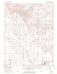
1967 Map of Gorham
USGS Topo · Published 1968About this map
The town of Gorham serves as a central hub for the extensive petroleum production defining this portion of the Kansas landscape in the mid-1960s. The map reveals a dense network of energy infrastructure, including the Gorham Oil Field, Fairport Oil Field, and the Emmeram Oil Field. Beyond the industry, the survey provides a detailed view of local burial sites like St Marys Cem and Gorham Cem, which are essential for genealogical research in this rural corridor.
Find a feature on this map
25 named features on this map. Tap any name to fly to it.
Don’t see what you’re looking for? This feature index may not catch every label — zoom into the map to look around manually.
Map Details
Editions of this 1967 Gorham Map
This is the sole edition of this map. No revisions or reprints were ever made.
Other maps of this area

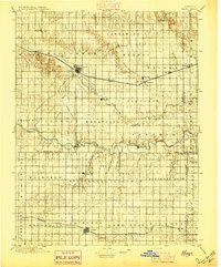
1896 · Osborne
USGS Topo · 1:125,000

1896 · Russell
USGS Topo · 1:125,000
1896 · Hays
USGS Topo · 1:125,000

1896 · Plainville
USGS Topo · 1:125,000

1955 · Great Bend
USGS Topo · 1:250,000

1955 · Beloit
USGS Topo · 1:250,000

1957 · Great Bend
USGS Topo · 1:250,000

1958 · Great Bend
USGS Topo · 1:250,000

1959 · Beloit
USGS Topo · 1:250,000
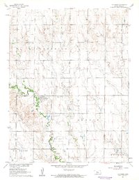
1961 · Catharine
USGS Topo · 1:24,000