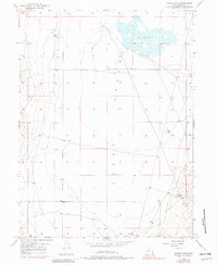
1947 Map of Goshen Pass
USGS Topo · Published 1982About this map
Cedar Valley defines this portion of the Utah landscape, characterized by its wide basins and isolated water sources. This 1947 survey, later updated with photorevised details, reveals a sparse network of infrastructure primarily supporting ranching and resource management. The map highlights the intermittent hydrologic features of the region, including the depression known as the Sinks and several strategically placed Well sites and a Reservoir for livestock or local needs. In the southeast corner, the terrain transitions at Goshen Pass, providing a natural corridor through the surrounding hills. This sheet is particularly valuable for understanding the distribution of water improvements and dirt tracks in a high-desert environment before modern development altered the drainage patterns.
Find a feature on this map
5 named features on this map. Tap any name to fly to it.
Don’t see what you’re looking for? This feature index may not catch every label — zoom into the map to look around manually.
Map Details
Editions of this 1947 Goshen Pass Map
2 editions found
Other maps of this area

1885 · Salt Lake
USGS Topo · 1:250,000

1885 · Tooele Valley
USGS Topo · 1:250,000

1915 · Fairfield
USGS Topo · 1:62,500

1917 · Fairfield
USGS Topo · 1:62,500

1947 · Fivemile Pass
USGS Topo · 1:62,500

1947 · Allens Ranch
USGS Topo · 1:24,000

1947 · Boulter Peak
USGS Topo · 1:24,000

1947 · Goshen Pass
USGS Topo · 1:24,000

1949 · Allens Ranch
USGS Topo · 1:24,000

1949 · Fivemile Pass
USGS Topo · 1:24,000