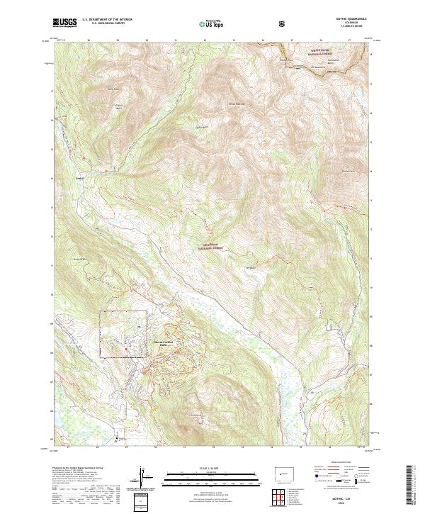
2022 Map of Gothic
USGS Topo · Published 2022About this map
Gothic and Mount Crested Butte anchor this high-elevation landscape where the White River National Forest meets the Gunnison National Forest. The map captures a detailed network of summer and winter recreation routes, including the Schofield Pass Ski Trl and the W Brush Creek Snowmo/Ski Trl, which reflect the area's transition from historical mining outpost to a major center for alpine research and skiing. The terrain is defined by significant peaks such as Avery Peak and White Rock Mtn, while the Crested Butte Cem sits near the Slate River at the southern edge, providing a grounded point for genealogical research. Water features like Meridian Lake and the dramatic Judd Falls on Copper Cr illustrate the drainage patterns that have shaped these basins and valleys for centuries.
Find a feature on this map
78 named features on this map. Tap any name to fly to it.
Don’t see what you’re looking for? This feature index may not catch every label — zoom into the map to look around manually.
Map Details
Editions of this 2022 Gothic Map
This is the sole edition of this map. No revisions or reprints were ever made.
Other maps of this area

1888 · Crested Butte
USGS Topo · 1:62,500

1888 · Anthracite
USGS Topo · 1:62,500

1889 · Crested Butte
USGS Topo · 1:62,500

1889 · Anthracite
USGS Topo · 1:62,500

1893 · Anthracite
USGS Topo · 1:62,500

1893 · Crested Butte
USGS Topo · 1:62,500

1893 · Aspen
USGS Topo · 1:62,500

1894 · Anthracite
USGS Topo · 1:62,500

1895 · Aspen
USGS Topo · 1:62,500

1909 · Mount Jackson
USGS Topo · 1:125,000