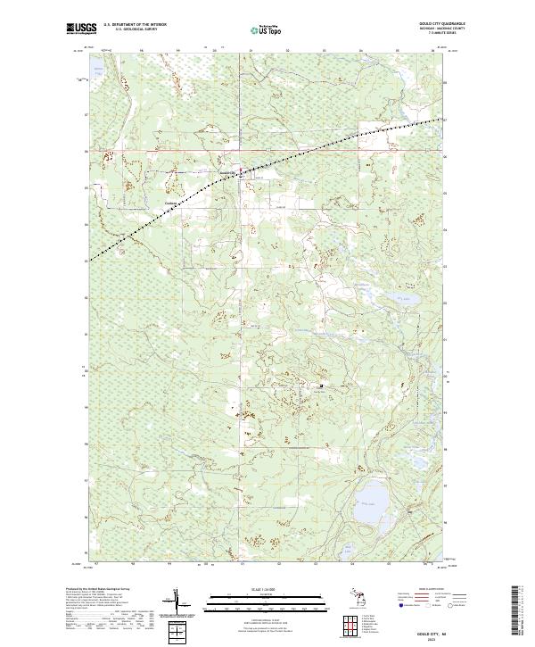
2023 Map of Gould City
USGS Topo · Published 2023About this map
Gould City and the neighboring settlement of Corinne serve as the primary human hubs in this part of Mackinac County, situated along a network of routes including Hiawatha Trl and S Gould City Rd. The landscape is defined by its complex hydrology, characterized by numerous named ponds and creeks that drain into Duel Lake and the smaller Mud Lake to the south. Notable water features such as Amadon Pond, Sherman Pond, and Burns Pond are concentrated in the eastern portion of the sheet, connected by McEachern Creek and the Crow River. For those investigating family history, the presence of the Polley Family Cem near Polley Rd offers a specific point of genealogical interest. The region's geography transitions from the wet expanses of Scrams Marsh to the isolated waters of Mitten Lake, reflecting the varied wetlands of Michigan's Upper Peninsula.
Find a feature on this map
40 named features on this map. Tap any name to fly to it.
Don’t see what you’re looking for? This feature index may not catch every label — zoom into the map to look around manually.
Map Details
Editions of this 2023 Gould City Map
This is the sole edition of this map. No revisions or reprints were ever made.
Other maps of this area

1931 · Gould City NE
USGS Topo · 1:31,680

1931 · Seul Choix Point NE
USGS Topo · 1:31,680

1931 · Gould City NW
USGS Topo · 1:31,680

1931 · Blaney NE
USGS Topo · 1:31,680

1931 · Gould City SE
USGS Topo · 1:31,680

1931 · Blaney SE
USGS Topo · 1:31,680

1954 · Sault Sainte Marie
USGS Topo · 1:250,000

1955 · Cheboygan
USGS Topo · 1:250,000

1956 · Sault Sainte Marie
USGS Topo · 1:250,000

1957 · Sault Sainte Marie
USGS Topo · 1:250,000