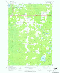
1973 Map of Gould City
USGS Topo · Published 1977About this map
Gould City serves as the central hub of this upper peninsula landscape during the early 1970s. The settlement pattern is defined by the intersection of local roads and the railroad line, which includes the Swift Siding to the east. Much of the surrounding area is part of the Mackinac State Forest, characterized by a complex network of wetlands, marshes, and numerous small water bodies. The presence of several gravel pits near the town and along the rail corridor suggests the local importance of aggregate extraction for road and track maintenance in this timber-rich region. The map reveals a transition between established homesteads and the expansive, undeveloped forest lands that define the character of Mackinac County.
Find a feature on this map
2 named features on this map. Tap any name to fly to it.
Don’t see what you’re looking for? This feature index may not catch every label — zoom into the map to look around manually.
Map Details
Editions of this 1973 Gould City Map
This is the sole edition of this map. No revisions or reprints were ever made.
Other maps of this area

1931 · Gould City NE
USGS Topo · 1:31,680

1931 · Seul Choix Point NE
USGS Topo · 1:31,680

1931 · Gould City NW
USGS Topo · 1:31,680

1931 · Blaney NE
USGS Topo · 1:31,680

1931 · Gould City SE
USGS Topo · 1:31,680

1931 · Blaney SE
USGS Topo · 1:31,680

1954 · Sault Sainte Marie
USGS Topo · 1:250,000

1955 · Cheboygan
USGS Topo · 1:250,000

1956 · Sault Sainte Marie
USGS Topo · 1:250,000

1957 · Sault Sainte Marie
USGS Topo · 1:250,000