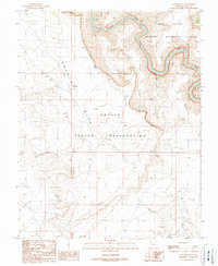
1989 Map of Goulding NE
USGS Topo · Published 1989About this map
The San Juan River carves a deep, winding path through this corner of the Utah desert, marking a stark topographical boundary between the high plateaus and the canyon floor. Much of the northern terrain is defined by the Cedar Mesa and Glen Canyon within the Glen Canyon National Recreation Area, where the river's course includes the turbulent Ross Rapids. This 1989 provisional map illustrates the intersection of federal protected lands and the northern reaches of the Navajo Indian Reservation.
Find a feature on this map
11 named features on this map. Tap any name to fly to it.
Don’t see what you’re looking for? This feature index may not catch every label — zoom into the map to look around manually.
Map Details
Editions of this 1989 Goulding NE Map
This is the sole edition of this map. No revisions or reprints were ever made.
Other maps of this area

1886 · Henry Mountains
USGS Topo · 1:250,000

1886 · Abajo
USGS Topo · 1:250,000

1892 · Abajo
USGS Topo · 1:250,000

1892 · Henry Mountains
USGS Topo · 1:250,000

1893 · Abajo
USGS Topo · 1:250,000

1952 · Clay Hills 4 SW
USGS Topo · 1:24,000

1952 · Clay Hills 4 SE
USGS Topo · 1:24,000
1952 · Bluff 3 SW
USGS Topo · 1:24,000

1956 · Escalante
USGS Topo · 1:250,000

1956 · Cortez
USGS Topo · 1:250,000