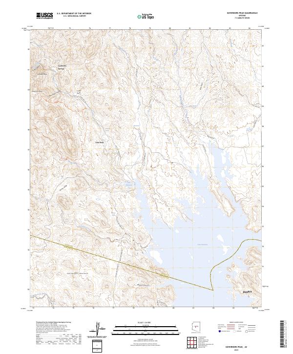
2023 Map of Governors Peak
USGS Topo · Published 2023About this map
Castle Hot Springs and the surrounding desert landscape of Yavapai County define this modern topographic survey, where the Bradshaw Mountains foothills give way to the rising waters of Lake Pleasant. The map captures a rugged interior punctuated by namesake summits like Governors Peak and Salvation Peak, alongside the protected reaches of the Hells Canyon Wilderness. Historically significant water sources, including Hot Spring, Alkali Spring, and Mitchell Spring, remain vital landmarks in a terrain carved by French Creek and Cow Creek. In the southern reaches, the boundary between Yavapai and Maricopa counties cuts through the Hieroglyphic Mountains near the modern northern fringes of Peoria. This document traces the essential road network connecting these remote sites, from Castle Hot Springs Road to the winding paths of Cougars Run and Table Mesa Road.
Find a feature on this map
47 named features on this map. Tap any name to fly to it.
Don’t see what you’re looking for? This feature index may not catch every label — zoom into the map to look around manually.
Map Details
Editions of this 2023 Governors Peak Map
This is the sole edition of this map. No revisions or reprints were ever made.
Other maps of this area

1887 · Prescott
USGS Topo · 1:250,000

1892 · Prescott
USGS Topo · 1:250,000

1903 · Bradshaw Mountains
USGS Topo · 1:125,000

1947 · Crown King
USGS Topo · 1:62,500

1947 · Bumblebee
USGS Topo · 1:62,500

1948 · Bumblebee
USGS Topo · 1:63,360

1948 · Crown King
USGS Topo · 1:63,360

1950 · Crown King
USGS Topo · 1:62,500

1950 · Bumblebee
USGS Topo · 1:62,500

1950 · Prescott
USGS Topo · 1:250,000