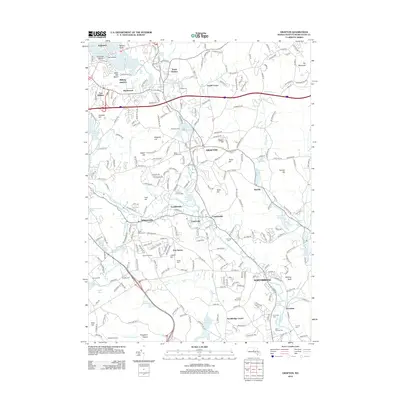
2012 Map of Grafton
USGS Topo · Published 2012About this map
Grafton and the surrounding Worcester County countryside are defined by the winding course of the Blackstone River, which anchors a string of industrial-era villages including Fisherville, Farnumsville, and Saundersville. The landscape is a complex mix of historical residential clusters like Wilkinsonville and North Grafton, interspersed with significant water bodies such as Lake Ripple and Flint Pond. The mapping reveals a transition from these denser settlement patterns to more agricultural and open spaces, exemplified by the Keown Orchard near East Sutton.
Find a feature on this map
276 named features on this map. Tap any name to fly to it.
Don’t see what you’re looking for? This feature index may not catch every label — zoom into the map to look around manually.
Map Details
Editions of this 2012 Grafton Map
This is the sole edition of this map. No revisions or reprints were ever made.
Other maps of this area

1885 · Worcester
USGS Topo · 1:62,500

1886 · Worcester
USGS Topo · 1:62,500

1886 · Blackstone
USGS Topo · 1:62,500

1887 · Marlboro
USGS Topo · 1:62,500

1889 · Marlboro
USGS Topo · 1:62,500

1889 · Blackstone
USGS Topo · 1:62,500

1889 · Webster
USGS Topo · 1:62,500

1892 · Webster
USGS Topo · 1:62,500

1892 · Worcester
USGS Topo · 1:62,500

1893 · Blackstone
USGS Topo · 1:62,500