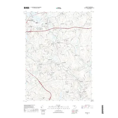
2018 Map of Grafton
USGS Topo · Published 2018About this map
The Blackstone River valley dominates this landscape, anchoring a chain of industrial-era mill settlements from Saundersville and Fisherville to Farnumsville. This waterway, once a primary power source for New England manufacturing, is paralleled by historical transport routes like the Hartford Pike and the rail corridors near Millbury Junction. The map reveals the dense layering of community life in Grafton and Northbridge, where numerous burial grounds such as Riverside Cem and Saint Johns Cem provide critical touchpoints for genealogical research. Further north, the Tufts Univ Grafton Campus marks the modern evolution of the landscape, while the southern reaches feature the striking geological formation of Purgatory Chasm. The distribution of smaller settlements like Axtell Corner and Kittville illustrates the transition from river-centered industry to the upland agricultural hills that surround the valley.
Find a feature on this map
81 named features on this map. Tap any name to fly to it.
Don’t see what you’re looking for? This feature index may not catch every label — zoom into the map to look around manually.
Map Details
Editions of this 2018 Grafton Map
This is the sole edition of this map. No revisions or reprints were ever made.
Other maps of this area

1885 · Worcester
USGS Topo · 1:62,500

1886 · Worcester
USGS Topo · 1:62,500

1886 · Blackstone
USGS Topo · 1:62,500

1887 · Marlboro
USGS Topo · 1:62,500

1889 · Marlboro
USGS Topo · 1:62,500

1889 · Blackstone
USGS Topo · 1:62,500

1889 · Webster
USGS Topo · 1:62,500

1892 · Webster
USGS Topo · 1:62,500

1892 · Worcester
USGS Topo · 1:62,500

1893 · Blackstone
USGS Topo · 1:62,500