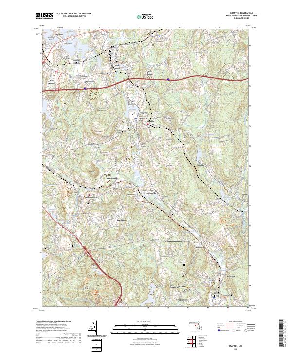
2024 Map of Grafton
USGS Topo · Published 2024About this map
Grafton and the industrial corridor of the Blackstone River define this Worcester County landscape. The map details a dense network of early settlements including Saundersville, Fisherville, and Farnumsville, places that grew around the river's power. Genealogists will find a high concentration of burial sites, from the Old Oak Street Burial Ground and Indian Burying Ground to the Friendly Hassanamiscos Burial Ground, reflecting a deep and complex local history. The transition from industrial infrastructure to modern recreation is evident in the Blackstone River Bikeway Trl and the Millbury Rail Trl, which follow the paths of former rail lines. To the north, the Tufts University - Grafton Campus occupies a significant portion of the terrain near Axtell Corner. The southern portion of the sheet is marked by unique geologic and landmarks like Purgatory Chasm and Shining Rock, alongside established communities such as Northbridge and Whitinsville.
Find a feature on this map
92 named features on this map. Tap any name to fly to it.
Don’t see what you’re looking for? This feature index may not catch every label — zoom into the map to look around manually.
Map Details
Editions of this 2024 Grafton Map
This is the sole edition of this map. No revisions or reprints were ever made.
Other maps of this area

1885 · Worcester
USGS Topo · 1:62,500

1886 · Worcester
USGS Topo · 1:62,500

1886 · Blackstone
USGS Topo · 1:62,500

1887 · Marlboro
USGS Topo · 1:62,500

1889 · Marlboro
USGS Topo · 1:62,500

1889 · Blackstone
USGS Topo · 1:62,500

1889 · Webster
USGS Topo · 1:62,500

1892 · Webster
USGS Topo · 1:62,500

1892 · Worcester
USGS Topo · 1:62,500

1893 · Blackstone
USGS Topo · 1:62,500