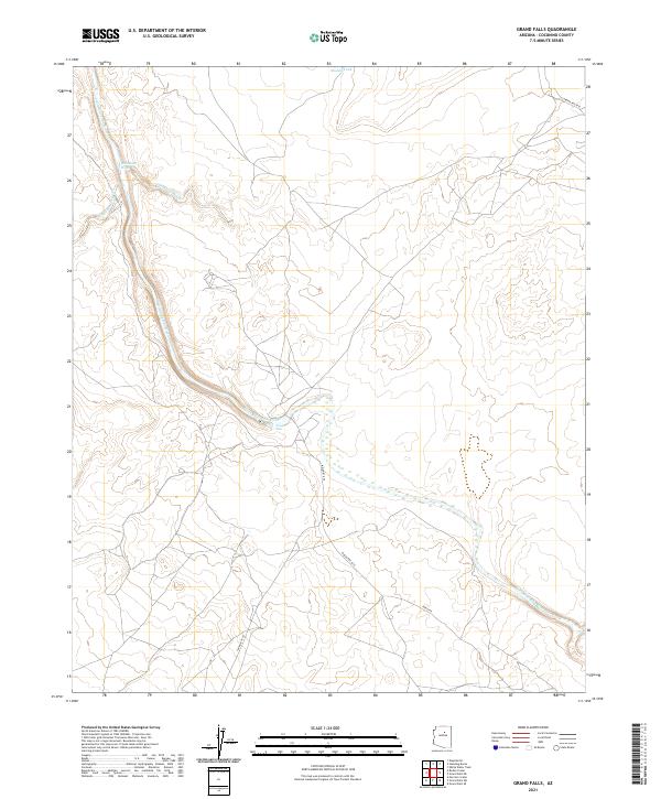
2021 Map of Grand Falls
USGS Topo · Published 2021About this map
The Little Colorado River defines the arid landscape of this Coconino County terrain, carving a winding path through the volcanic and sandstone formations of the high desert. The river's most significant geographic break occurs at Grand Falls, a massive tiered drop created by prehistoric lava flows. This survey by the U.S. Geological Survey details the complex drainage network feeding into the river, including the Dinnebito Wash and Little Roden Wash, which underscore the region's intermittent water systems. Movement through this remote area is facilitated primarily by tribal road networks like Indian Rte 6910 and Indian Rte 6732, connecting the township boundaries of T24N and T25N. These corridors provide a look at the modern land management within the Navajo Nation, where vital resources like the Muddy Tank support the local livestock and ranching traditions.
Find a feature on this map
14 named features on this map. Tap any name to fly to it.
Don’t see what you’re looking for? This feature index may not catch every label — zoom into the map to look around manually.
Map Details
Editions of this 2021 Grand Falls Map
This is the sole edition of this map. No revisions or reprints were ever made.
Other maps of this area

1886 · San Francisco Mtns
USGS Topo · 1:250,000

1891 · San Francisco Mtns
USGS Topo · 1:250,000

1894 · San Francisco Mtns
USGS Topo · 1:250,000

1899 · San Francisco Mtns
USGS Topo · 1:250,000

1947 · Flagstaff
USGS Topo · 1:250,000

1954 · Flagstaff
USGS Topo · 1:250,000

1955 · Grand Falls NE
USGS Topo · 1:24,000

1955 · Black Falls 4 SW
USGS Topo · 1:24,000
1955 · Black Falls 4 SE
USGS Topo · 1:24,000

1958 · Flagstaff
USGS Topo · 1:250,000