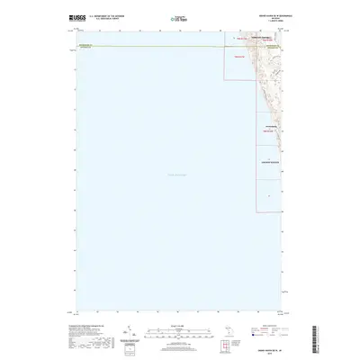
2019 Map of Grand Haven OE W
USGS Topo · Published 2019About this map
Lake Michigan dominates the western expanse of this coastal study, illustrating the transition from the open waters to the residential shorelines of West Michigan. The map highlights the northern edge of Grand Haven and the community of Ferrysburg, showing the dense grid of coastal development and local thoroughfares like N Shore Dr and N Shore Estates Rd. To the north, the boundary between Muskegon Co and Ottawa Co bisects the map, with the southern fringes of Norton Shores appearing just above the line. The terrain is marked by the winding routes of Hoffmaster Dr and Black Lake Rd, which serve as primary access points to the forested dunes and lakefront properties. This layout provides a clear view of the modern residential landscape and public access points along this stretch of the lakeshore during the late 2010s.
Find a feature on this map
15 named features on this map. Tap any name to fly to it.
Don’t see what you’re looking for? This feature index may not catch every label — zoom into the map to look around manually.
Map Details
Editions of this 2019 Grand Haven OE W Map
This is the sole edition of this map. No revisions or reprints were ever made.
Other maps of this area

1929 · Holland
USGS Topo · 1:62,500

1930 · Lake Harbor
USGS Topo · 1:48,000

1930 · Muskegon
USGS Topo · 1:62,500

1932 · Holland
USGS Topo · 1:62,500

1936 · Muskegon
USGS Topo · 1:62,500

1936 · Lake Harbor
USGS Topo · 1:62,500

1954 · Milwaukee
USGS Topo · 1:250,000

1958 · Milwaukee
USGS Topo · 1:250,000

1958 · Racine
USGS Topo · 1:250,000

1962 · Racine
USGS Topo · 1:250,000